
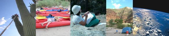
Program Dates and Activities
-
Saturday January 26, 2013
Water Resources
8:30 a.m. to 4:00 p.m.
Location: Arizona-Sonora Desert Museum - The Colorado River has been called the "American Nile". Thirty million people in the Southwest depend on its water. We will explore the basic science and management of this river using several exercises from Arizona Project WET's "Discover a Watershed: The Colorado River Educators Guide." We will examine changes in the river over time using remotely sensed images from satellites, and learn about how this rapidly evolving technology can be used to document and study changing water resources.
-
Saturday February 16, 2013
Sonoran Desert Biodiversity
8:30 a.m. to 4:00 p.m.
Location: Arizona-Sonora Desert Museum - The Sonoran Desert is one of the most biodiverse deserts in the World, however populations of many native species are declining due to human activities such as habitat conversion, introduction of invasive species and over-exploitation of physical and biological resources. Climate change generally exacerbates many of these problems. We will learn basic field methods for describing biodiversity, and measure biodiversity around the Arizona-Sonora Desert Museum. We will also learn about some biodiversity investigations you can do around your school, and the opportunities and challenges inherent in studying biodiversity from space.
-
Saturday March 30, 2013
Riparian Ecosystems
8:30 a.m. to 4:00 p.m.
Location: Agua Caliente Park - Riparian zones are easy to pick out in the desert as ribbons of green along waterways. They play a major role in maintaining the biodiversity of the Sonoran Desert Region by providing water, a variety of habitats and food sources, and corridors for animals to move from place to place. Water quality and quantity can vary greatly in these systems and both have major effects on the animals and plants living in and along the water. We'll learn how to measure flow and calculate discharge rates, make basic water quality measurements and compare biodiversity of the riparian ecosystem to some of our Desert Museum sites. We'll also spend some time looking at desert and riparian vegetation in satellite images and learn about the creation and uses of false-color imagery.
-
Saturday May 4, 2013
Sky Island Ecosystems
8:30 a.m. to 4:00 p.m.
Location: University of Arizona - Our mountain tops, or "sky islands" support an almost completely different community of plants and animals from the lowland deserts. The range of topography in the Sonoran Desert Region, and the connectivity with mountain ranges to the south and north contribute greatly to the biodiversity we find here. Warmer, dryer weather predicted by climate models may mean that some sky island species will no longer be well adapted to these mountain tops. Combined with a long history of fire suppression, conditions for summer fires are prime. We'll explore some activities to teach about climate change globally and in the southwest, meet with climate change researchers to hear about regional impacts, and examine time series satellite images of mountain top "sky islands" to look for evidence of change. We'll also look at detailed images of Mount Lemmon and start to plan individual or team inquiry projects for the mountain.
-
Tues May 28 - Wed May 29, 2013
Sky Island Ecosystems
8:00 a.m. to 5:00 p.m.
Location: Mount Lemmon Sky Center - Plan and carry out your own field investigation applying some of the tools you've learned about over the spring semester. Compare satellite imagery with observations on the ground. Communicate the results of your investigations using appropriate science skills and technology. Spend a night stargazing and planet spotting at the Mount Lemmon Sky Center.
-
Mon June 10-Thurs June 13, 2013
Urban Ecosystems
8:30 a.m. to 4:00 p.m.
Locations: Tucson, various - During this week we'll focus on measuring and visualizing human impacts on our regional and global environments using satellite images. In addition to visiting some local landmarks of urban infrastructure, we'll look at our city and others from space, examining changes over time. We'll consider different ways of calculating and visualizing our effects on the planet, both collectively and individually, and discuss the meaning of concepts such as "eco-footprint" and "sustainability". You will design a poster using satellite imagery to communicate an idea about human impacts to our planet. These posters will be exhibited at the Desert Museum later in the year. We'll explore activities for helping students understand their impacts, as well as learn how they can lower them through conservation and innovation. You can use these activities, as well as others we will brainstorm, in developing your implementation plans for the classroom or after-school Earth Clubs.
-
Saturday August 17, 2013
Present Implementation Plans
1:00 p.m. to 4:00 p.m.
Location: ASDM - Over the summer, you will develop a plan for using some of the Earth Camp activities in your classroom, and/or in after school clubs. These clubs will be part of a loose network of "Earth Clubs" made up of former Earth Camp teachers and student alumni, as well as other after school science and environment clubs with similar interests. Earth Clubs receive support from the Desert Museum, Planetary Science Institute and Arizona Project WET in the form of curriculum units, visits to your club meetings with live animals, help in performing water audits or outdoor inquiry, astronomy activities, and information about community service and citizen science projects. On August 25th we will meet to share these plans and swap ideas. Everyone is then welcome to stay for Teacher Appreciation Night at the Desert Museum from 5 pm to 10 pm.
-
Saturday November 2, 2013
Presentations and Poster Exhibit
8:30 a.m. to 4:00 p.m.
Location: ASDM - We'll reconvene one last time to hear your reports on classroom or club-based implementation, and to view the final versions of the posters you created in the summer. Additional resources for using satellite data in your classroom will be presented. We'll celebrate our success together!